
Network
Python module for building and analyse geographic network.
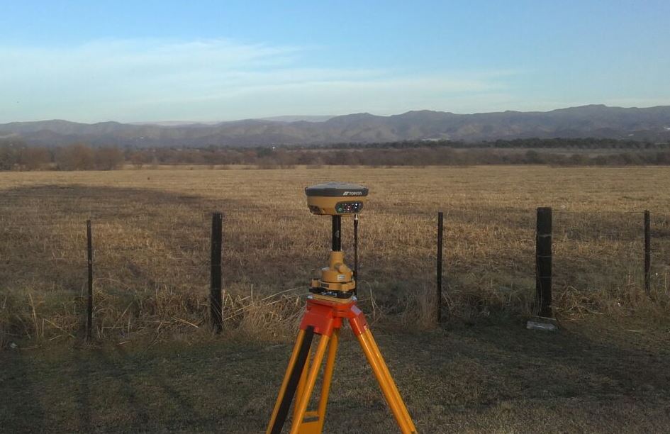
Data Adquisition - Surveying
Scaning and measuring a world in constant changing and evoution, to provide accurate and updated data essential for a good solution design and desicion making process.
- Topography
- Geodesy
- Hidrogaphy
- Photogrammetry
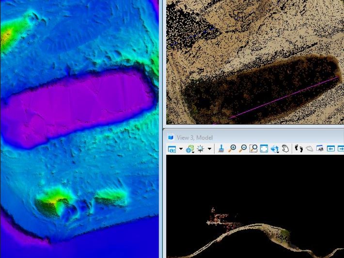
Spatial Data Processing ⭐
Before any juice can be extracted from the data, it must be managed to get the best of it.
- Data Exploration (ESDA)
- Data Cleaning
- Data Wranggling
- Topographic/Geodesic Data Processing
- Point Cloud Processing
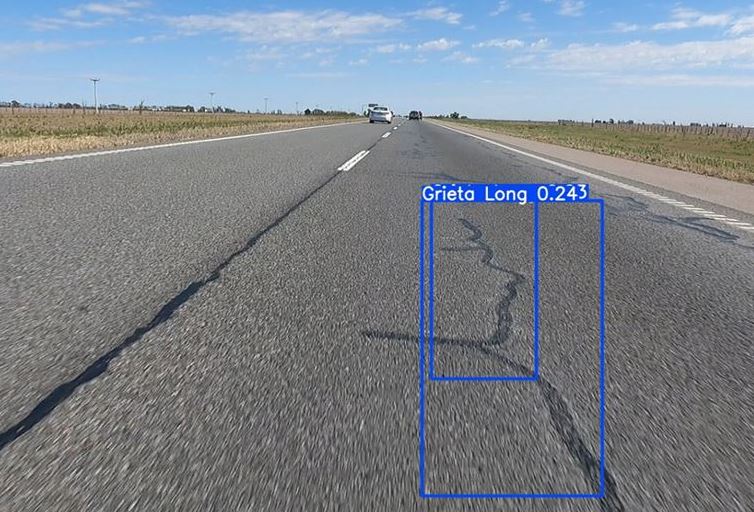
Spatial Data Analysis ⭐
Whether the data is structured, images, point cloud... using data analysis and machine learning techniques to generate new information and create insight from it.
- Vector Analysis
- Raster Analysis
- Network Analysis
- Geostatistic Analysis
- Machine Learning
- Deep Learning
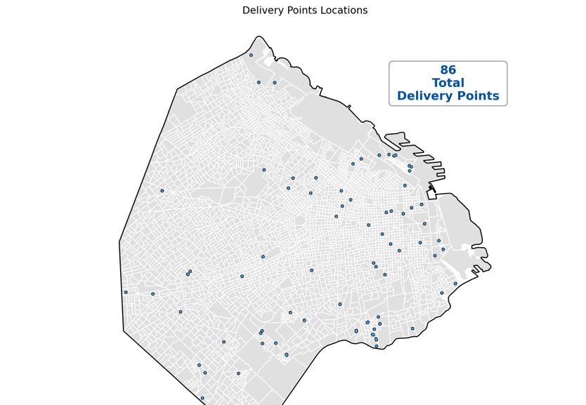
Data Visualization
"A picture is worth a thousand words". Information shown in charts and maps is more easily procesed, letting you make a better understanding of it.
- Reports
- Charts
- Maps
- Infographics
- Technical Drawing
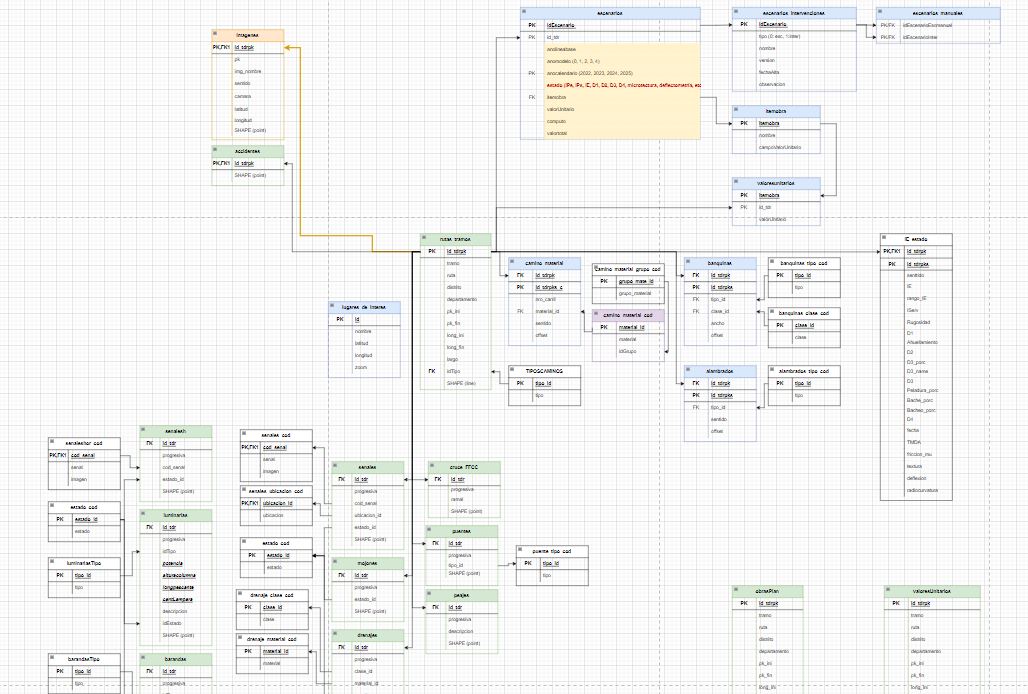
Spatial Databases
Help analyse and create strutured databases, to gather data in a consistent way.
- GIS Data Structure Design
- Database Implementation
- Database Documentation
- ETL Processes
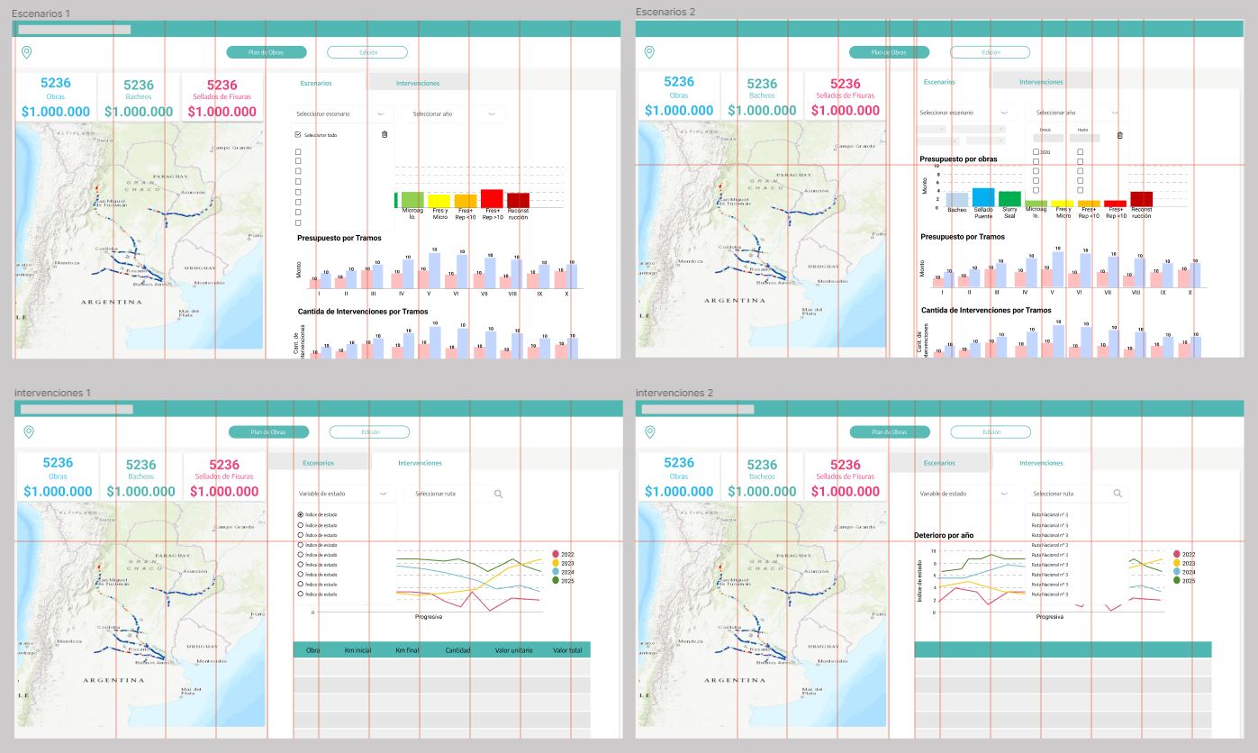
Web maps and dashboards design
Make your own analysis and exploration of the data through the easy and powerful interaction of an app.
- Dashboard Design
- Web apps Design
- Prototyping